CAUTION: City, County & State All Issue Weather Warnings
The City of Rye, Westchester County and the New York State Police have all issued severe weather warnings as of early Thursday afternoon. The City will have extra police and fire staff working during the impending storm.
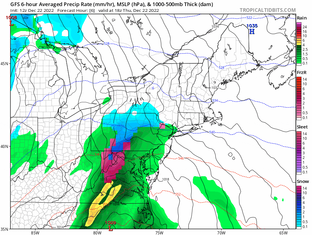
Weather services are predicting heavy rainfall with moderate flooding and heavy winds Thursday into Friday and then plummeting temperatures with icy roads and a chance of snow showers Friday evening into Saturday.
Residents are encouraged to check their storm drains, secure any items that might become airborne and avoid driving once the temperature drops due to icy road conditions.
City of Rye Storm Warning
Westchester County Executive George Latimer is urging residents to be prepared for possible flooding and power outrages due to the significant rain storm and high winds that will affect Westchester through Friday night.
Localized flooding is projected and could impact roadways and low-lying, flood-prone areas, particularly along the Long Island Sound shoreline, Latimer said. He also noted that high winds can topple trees and large branches on to power lines and cause widespread outages. By Friday afternoon, he said, temperatures are expected to plunge to below freezing, making travel hazardous due to the potential for icy roadways.
“Mother Nature is throwing us a curveball as we head toward Christmas weekend. The National Weather Service projects that Westchester will deal with a lot of rain and high winds, followed by a quick turnaround on Friday from unseasonably warm temperatures to sub-freezing temperatures. We face a range of hazards from rain, strong winds and low temperatures.”
Commissioner Richard G. Wishnie of the Department of Emergency Services advised residents to take some simple precautions today to prevent damage that can be caused by flooding or high winds.
He urged persons who live in flood-prone areas to move their cars to higher ground and to elevate items in their basement if it has flooded previously in significant storms. He also recommended that people secure garbage cans and other items kept in yards or on decks that might be become airborne in high winds.
County emergency management personnel recommend residents set aside several days’ worth of non-perishable food, water and medicine, and keep other critical supplies on hand like flashlights and batteries in case they are stuck in their homes without power. Residents should also have a “go-bag” ready in case they are asked to evacuate on short notice during an emergency.
Westchester County Police will deploy additional Patrol and Emergency Service Unit officers to assist with removing downed trees on parkways and closing roads if needed due to flooding. Staff in the Office of Emergency Management at DES will be monitoring the weather and power outages, and will be providing updates and support to all municipalities in the County.
In conjunction with the Department of Emergency Services, the Department of Public Works & Transportation will be monitoring the progress of the storm and its impact. DPW&T will also have an overnight crew during the storm Thursday night and will also monitoring the road conditions for the rapid temperature drop expected Friday afternoon. Drivers are asked to consider the high possibility of black ice on roadways if they have to drive when temperatures drop. If possible, people are advised to avoid driving Friday afternoon through Saturday morning.
In the event of a power outage, the Westchester County Department of Health reminds residents to use gas-powered tools and generators outdoors only and to take care when using alternate heating sources.
Health Commissioner Sherlita Amler, MD, said the predicted cold temperatures for Friday increase the risk of frostbite or hypothermia, particularly if power outages occur. Seniors and infants less than one year of age should never sleep in a cold room and should be dressed in warm clothing to prevent the loss of body heat. If a safe temperature cannot be maintained inside your home, make temporary arrangements to stay elsewhere.
If you lose power, call Con Edison or NYS Electric and Gas directly. The phone numbers are: Con Ed power outage or gas and electrical service problems: (800) 75-CONED; NYSEG electricity power outage: (800) 572-1131; NYSEG gas power outage: (800) 572-1121. Practical tips on emergency readiness can be found at: https://emergencyservices.westchestergov.com/severe-weather or https://www.ready.gov/.
New York State Police Warning
Blizzard conditions put motorists at risk, be prepared for a holiday inconvenience during the upcoming winter storm
Troopers will be out checking all major routes of travel to ensure that motorists are as safe as possible and working with local Emergency Operations Centers.
Extreme winds, whiteout conditions and dangerously cold temperatures will make travel on Friday December 23, and Saturday, December 24, highly dangerous. State Police advise motorists to drive only for emergency purposes. If you are on the roadways make sure you have a full tank of gas, food and extra warming items in your vehicle in case emergency vehicles have a delayed response due to the extreme storm conditions.
Use your best judgment to determine if driving is prudent. Remember, if you can’t see out your windshield, first responders can’t either.
Keep the following tips in mind:
- Get the latest weather forecast before leaving with your local weather apps, monitor radio or TV stations.
- Always clean your windows and mirrors FULLY of any snow and ice before driving.
- Keep a full tank of gas
- Fluid levels are sufficient ( windshield washer fluid, ant-freeze)
- Spare tire is sufficient and you have the jack and wheel wrench
- Use headlights at all times to increase your visibility to others. Remember, if your windshield wipers are in use due to weather, then your headlights must be on.
- Drive prudently. If the conditions are adverse, you should decrease your speed accordingly.
- Brake early
- Do NOT use cruise control. This decreases your reaction time to apply braking.
- Look out for events farther down the road. Creating more time to react can make a difference.
- Be aware of maintenance vehicles and emergency vehicles. Give them room to work.
- If you do not absolutely have to go out on the roads, then don’t.
If you do go out, is your vehicle prepared?
- Is your trunk supplied to help you to be safe in case you are stopped or stranded in an area without assistance readily available:
- Gloves, blankets, warmers, tool kit, first-aid kit, non-perishable foods, water, working flashlight and batteries, cell phone charger, etc
- Shovel, ice scraper, de-icer, snow brush, rock salt or cat litter, tow chain or cable, jumper cables or battery charger, etc.
If you are involved in a Collision or leave the roadway:
If you drive off the roadway and are stuck in a snow bank or ditch, stay in your vehicle and call 911. DO NOT exit your vehicle unless it is an absolute emergency. You put yourself at risk of being struck by another vehicle.
Roll your windows down a few inches or turn your vehicle off if you are stranded in snow for a period of time with your vehicle running. Tailpipes can become blocked by deep snow and cause carbon monoxide to build up inside the car, and can lead to serious physical injury or death
If you should become stranded on the Thruway or any roadway, know your location by being aware of your direction and mile post marker. This will help emergency personnel reach your location as quick as possible.